
Howgill Fells & Westmorland Walks
Hand Lake and Uldale Head
Date: 19th July 2008
Distance: 8 miles
Ascent: 1879 feet
Time: 3 hours 30 mins
With: On my own
Start Grid Ref: NY639053
Walk Summary:
An interesting walk based around the northern Howgills valley of Uldale visiting Hand Lake, Docker Knott, Uldale Head and Rispa Pike.
Route Summary: Gaisgill - Ellergill - Elliot Howe - Uldale Beck - Hand Lake - Docker Knott - Blakethwaite Botton - Uldale Head - Rispa Pike - Elliot Howe - Ellergill - Gaisgill
Photos: Click on the photos below to enlarge.
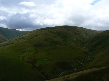


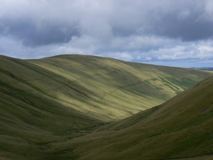


Walk Detail: Only my fourth Howgill walk this was, in some ways, probably the most satisfying yet. This was despite the fact that the journey to Uldale End and the virtually same return over Rispa Pike were fairly dull. However from Hand Lake to Rispa Pike the scenery was, despite the occasional interruption caused by low cloud, absolutely fantastic.
I struggled a bit climbing up Hand Lake but from then on I got my wind and actually found the steep pull up Uldale Head easier. So much looks similar in the Howgills but from various points I had great views of Simon’s Seat, Fell Head, Middleton, Hand Lake and the Churn Gill and Uldale valleys. Strangely the only fell I didn’t get a really good shot of was Uldale Head itself, the highest summit of the day.
Other than the views the highlights were seeing some more fell ponies (though from a distance) and managing a fairly decent walk without my knee strap. The only real negatives were that I lost yet another Hannon book and yet another bloody camera tripod - the hills and fells of Northern England are littered with my lost possessions.


Follow me on ...


