
Nidderdale & Washburn Walks
Norwood Edge & John O'Gaunt's Castle
Date: 31st January 2015
Distance: 8.2 miles
Ascent: 850 feet
Time: 4 hours 15 minutes
With: On my own
Start Grid Ref: SE207530
Walk Summary:
An interesting and varied walk including the plantations and outcrops of Norwood Edge before visiting a trio of reservoirs and the remains of a 14th century hunting lodge in Haverah Park.
Route Summary: Bland Hill - Brat Lane - Top Lane - Norwood Edge Plantation - Lindley Moor - Hunter's Stones - Little Alms Cliff - Scargill Reservoir - Beaver Dyke Reservoir - John O'Gaunt's Reservoir - John O'Gaunt's Castle - Brown Bank - Bland Hill
Photos: Click on the photos below to enlarge.


Walk Detail: After a couple of excellent walks on Darnbrook Fell and Giggleswick Scar respectively I was keen to get back to the Yorkshire Dales. However, due to family commitments in the afternoon, there was not the time so instead I plumped for this walk which was much closer to home.
I found the route for this walk in Paul Hannon's walking guide 'Harrogate and the Wharfe Valley'. It appealed to me because it contained a mixture of places that I like but haven't been to for a while, such as Norwood Edge and Little Alms Cliff, with a section at the head of Haverah Park which was new to me.
Hannon's route actually starts at the Forestry Commission car park on Stainburn Moor but due to some slushy snow I didn't fancy the drive up Broad Dubb Road to reach it. Instead I parked at a large layby at the bottom of the road in the small hamlet of Bland Hill.
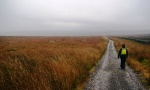
The first part of the walk, along pastures linking Bland Hill with Brat Lane and Top Lane, was given added interest by the snow on the ground and good views down to Swinsty Reservoir as well as Fewston Reservoir further up the Washburn Valley. Although seemingly far removed from Nidderdale this section of the walk, along with the final stages of the route, was in the Nidderdale Area of Outstanding Natural Beauty.
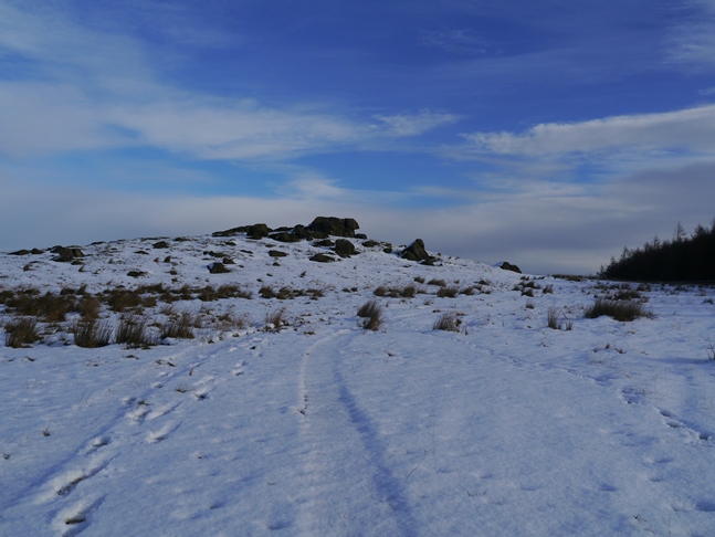
From Top Lane I followed a track in to Norwood Edge Plantation before taking a side path to head towards the trig point. On the Ordnance Survey database this trig point is named Lindley Moor. The trig point is situated on a high rocky outcrop which I didn't feel able to scramble up to on my first visit and was certainly not going to attempt it in the snow. Just after my arrival a couple of climbers arrived lugging their large crash mats but when they took a look at how icy it was they too decided that it was not worth the risk.
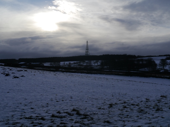
The view from the outcrops is excellent, particularly striking was the view up the Washburn Valley with the snow covered Great Whernside hovering in the background. Away to the east the Hambleton Hills escarpment could clearly be seen while closer by the 'golf balls' of Menwith Hill and the windfarm on Knabs Ridge were also prominent.
From the trig point I followed a very narrow path into the plantations in search of the Hunter's Stones. Along the way I came across a small clearing featuring a little wooden hut with broken windows and, most bizarrely, an old touring caravan. How on earth it managed to get there I don't know but I found it really quite surreal. Eventually I reached the snow covered rash of boulders called the Hunter's Stones. Were it not for the surrounding trees blocking the view it would be a good spot.
The next stage of the walk between the edge of the plantation and a stone wall was very awkward. The 'path' was a made up of soft thawing snow covering a mixture of wet mud, rocks and tussocks. After about ten minutes of carefully picking my way I lost concentration for one moment slipped and landed heavily on my right knee on a snow-covered rock. The initial pain was some of the intensest I've ever felt and I briefly thought I'd broken something. Fortunately when I tried to bend my knee it seemed to be working and after a couple of minutes I got up and continued on my way.
It was with some relief that I finally made my way out of the plantations and to the rocky outcrop of Little Alms Cliff. While not as dramatic as its big brother several miles to the south-east Little Alms Cliff is still a nice spot with some big views for such a modest altitude. From Little Alms Cliff I briefly followed the road to reach the permissive path down to Scargill Reservoir where I entered Haverah Park.
Haverah Park was originally created in the 12th century as a deer park in the Forest of Knaresborough. Given its origins as a hunting ground it is perhaps fitting that as I made my way down the track past Scargill Reservoir I met a number of shooters who were just packing up after what seemed like an all too successful pheasant shoot. While I had visited Scargill Reservoir once before I hadn't been to either Beaver Dyke Reservoir or John O'Gaunt's Reservoir. It was something of a suprise therefore to find the former was completely empty. Later I found out on the Yorkshire Water website that, due to the cost of maintenance, the reservoir was decommisioned the previous winter.
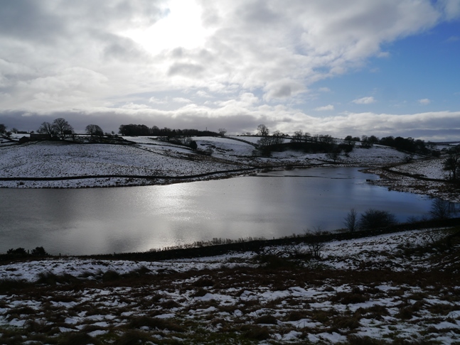
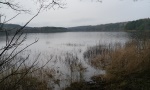
If Beaver Dyke Reservoir was a disappointment the next reservoir John O'Gaunt's Reservoir more than made up for it. More substantial than it looks on the map it was a lovely and very natural looking sheet of water. The view from a couple of memorial benches overlooking the reservoir from the north was particularly attractive. It is definitely a spot I'd like to return to.
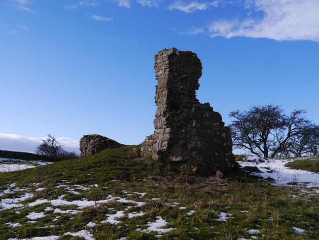
Standing on a small hill overlooking the reservoir from the south are an old abandoned farm, Haverah Park Top, and the meagre remains of John O'Gaunt's Castle. Thought to be the site of a 14th century hunting lodge it is built on a very obvious earthwork. The name comes from John of Gaunt, the son of King Edward III and who through his son Henry IV was the scion of the House of Lancaster.
From the ruins I then took a path through some more snow covered pastures to Brown Bank and then, finally, to Bland Hill. My painful fall aside this was an enjoyable and varied walk. Whilst I could feel my knee begin to swell after the fall it didn't impede me from completing the walk and all things considered I probably got away quite lightly with just a couple of grazes and some bruising. I was pleased to finally make the acquaintance of Haverah Park and hope to explore some more of it later on this year.
Follow me on ...


