
Cheviots Walks
Girdle Fell & Wool Meath
Date: 1st March 2014
Distance: 13.2 miles
Ascent: 1732 feet
Time: 7 hours 30 minutes
With: On my own
Start Grid Ref: NT763027
Walk Summary:
A tough and largely pathless walk through forest, heather and bog to the moorland tops of Girdle Fell and Wool Meath.
Route Summary: Byrness - Catcleugh Reservoir - Chattlehope - Cross Cleugh - Girdle Fell - White Crags - Girdle Stone - Wool Meath - Wool Meath Edge - Bittlestonegate Cairn - Ellis Crag - Redesdale Forest - Byrness
Photos: Click on the photos below to enlarge.


Video:
Walk Detail: This was the second walk of a long weekend based at the Forest View Walkers Inn in the tiny village of Byrness in Redesdale. The aim of the weekend was to bag some of the Dewey tops (hills over 500m) in the area.
The targets for this walk were Wool Meath and Girdle Fell. Actually the latter had been removed from the list of Deweys in August 2012 as a survey had found there wasn't the requisite 30m reascent from the col with Carter Fell. However, since I'd had it on my to-do list for so long I still felt I should do it. I instinctively knew this wasn't going to be an easy walk and when planning the route I could find virtually nothing online in regards other people having done a similar walk.
My plan was to walk up the A68 from Byrness to Catcleugh Reservoir and then take the bridleway from Chattlehope that heads over the flanks of Girdle Fell. When I questioned Joyce at Forest View as to whether she knew anything about the bridleway she said that the last walker she knew who'd been that way (who turned out to be Mike Knipe of Northern Pies fame) had found the bridleway to be almost non-existant.
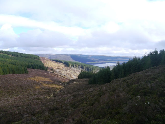
After walking carefully along the A68 I was treated to some beautiful views of Catcleugh Reservoir in the early morning spring sunshine. However, as Joyce predicted, once I reached the farmhouse at Chattlehope there was no sign of the bridleway or even a sign suggesting there was a bridleway. As I stood outside the farm pondering where to go the lady living in the house came out to collect some eggs and when questioned she kindly pointed out the gate I had to climb over and warned me the route would be very wet.
Not deterred I crossed over into a moist tussocky pasture to arrive at the point where the bridleway supposedly crosses Chattlehope Burn. Needless to say there was no sign of a ford or bridge so all I could do was wade across and continue on my way. In fact I managed to follow the route of the non-existant bridleway for another mile or so before I was eventually confronted with a wall of trees on the other side of Cross Cleugh. Finally giving up trying to trace the bridleway's route I instead climbed up via a fire break between the plantation edge and a deer fence above the south side of Cross Cleugh.
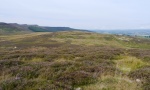
It was a rough ascent and very wet underfoot but I'd found a way out of the valley and in fact enjoyed the retrospective views back down to Catscleugh Reservoir. As I neared the top of the Cleugh I also heard my first skylarks of the year. Once at the top of Cross Cleugh it was a fairly straightforward walk across the pathless moor to the trig point on Girdle Fell. Situated on a very flat area of moorland the top of Girdle Fell wouldn't win any awards as a viewpoint but there is something about remote moorlands like these that I find irresistible.
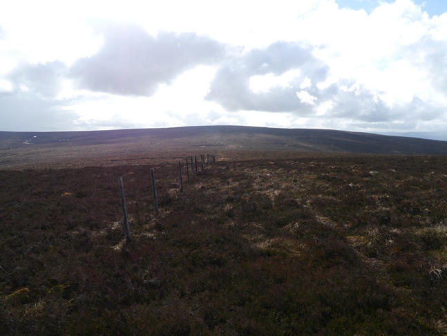
Rather than making straight for Wool Meath I first detoured to the top of White Crags, a modest rash of boulders that did however feature a cracking view down the length of the valley of White Kielder Burn. At the crags I was surprised to find a thin path, the first I'd seen since leaving Chattlehope. Unfortunately it soon disappeared into a maze of peat hags. I managed to negotiate the hags with little difficulty to meet up with the fence connecting Girdle Fell with Wool Meath. This I followed all the way to the latter with just another small detour to visit the Girdle Stone.
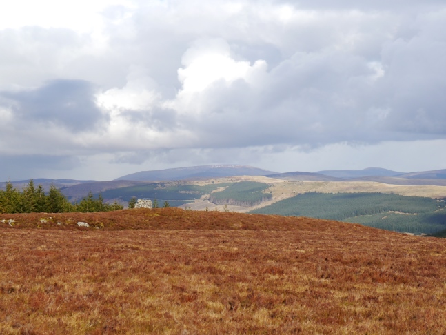
Wool Meath was another broad heathery top, the summit unmarked by cairn or trig point. At this point I had a couple of options, the longer but easier route would be to descend south towards the Kielder Forest Drive and follow it most of the way back to Byrness. The slightly shorter but rougher route would be to continue through the heather for a few more miles to the trig point on Ellis Crag and then try and find a route down through the forest. I was getting tired by this point and was sorely tempted by the thought of the Forest Drive but after spending about five minutes trying to make my mind up I decided to press on to Ellis Crag.
The next section over the inappropriately named Wool Meath Edge was particularly rough and tiring. The route I took was however punctuated by a series of well built and regularly spaced cairns. I wondered what purpose they originally served and why there should be so many on this shoulder of Wool Meath and no cairn on the moorland top itself. The final cairn I came across before reaching Ellis Crag was a particularly wide one and is even given a name on the map - 'Bittlestonegate Cairn'.
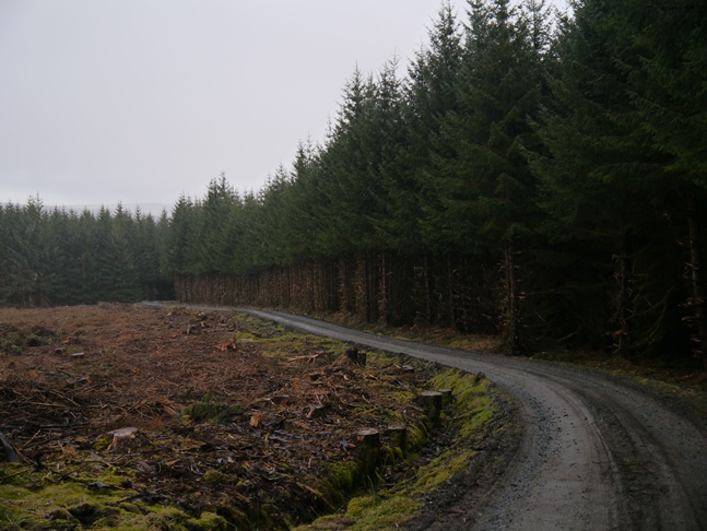
The col between Wool Meath Edge and Ellis Crag was as rough underfoot as anything so far on the walk but just as I was beginning to look forward to exploring the crag almost out of nowhere it began to snow! Only light snow mind but enough to largely obscure the views from Ellis Crag - hardly a just reward for all the effort I'd expended getting there. As the weather had turned so dramatically there was nothing to be gained by hanging around the summit so I carefully descended to a plantation edge which I followed to a forest road which eventually led me to a public footpath and back to Byrness.
Some walks provide a lot of rewards for very little effort, some walks are the exact opposite but often that which is hardest gained can be the most satisfying. Such was the case with this walk. Without doubt this was one of the toughest walks I've done to date and I got an immense amount of satisfaction for having done it. Having said that I'd be cautious about recommending it to anyone other than a fairly strong walker who knows what they are getting themselves in for. Probably not one to do in hill fog either.


Follow me on ...


